Geodiversity in the Little Ouse Headwaters
The Little Ouse Headwaters has a fascinating earth heritage. The valley reveals the story of local environmental change over the last 450,000 years
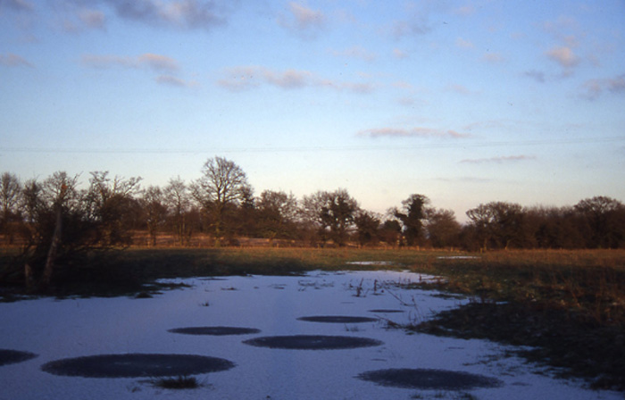
The slope at Blo'Norton Banks and The Lows was probably carved out by water action when the valley was a glacial meltwater channel. Buried layers of mud beneath the valley floor provide evidence for a lake here at the end of the last Ice Age, about 12,000 years ago.
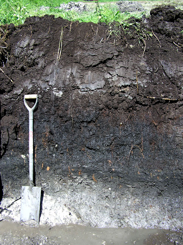
At Parkers Piece radio carbon dating shows that fen peats and marls began to accumulate around 8,000 years ago.
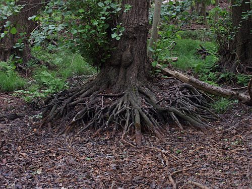
A Triffid at Hinderclay Fen wood? The stilt roots of this alder tree are evidence of peat wastage, caused by the impact of lowered water levels in the valley in recent years.
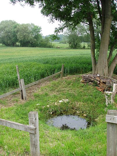
At St Mary’s Well, Hinderclay, lime-rich water wells up and is said to be good for curing sore eyes. Nearby finds of Roman artefacts suggests the well may have been a focal centre for over 1500 years.
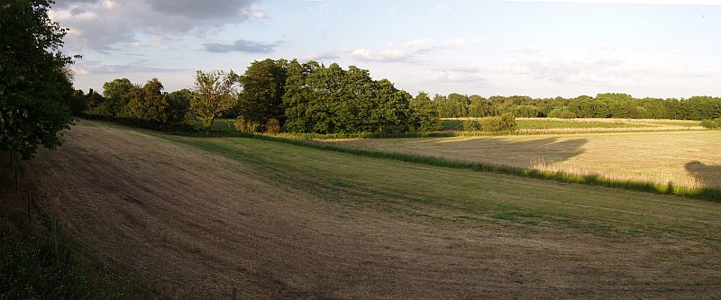
The soils of the Frith are underlain by sand rather than peat.
- The valley we see today originated in the Anglian glaciation (about 450,000 years ago). Ice sheets eroded the Chalk bedrock and deposited thick layers of glacial debris over the landscape; pressurised meltwater beneath the ice carved deep into the bedrock, initiating the ancestral valley.
- During later glacial periods, meltwater was ponded up in the Fenland basin, and the valley was an overflow route towards the North Sea. An arm of this Fenland lake may have filled the valley. Sands and gravels from these cold periods now underlie the valley floor, and also form terraced areas marking the remnants of former floodplains.
- The last Ice Age ended about 12,000 years ago. It left a legacy of spring-fed lakes in the valley. These have now vanished, but their buried sediments contain fossil pollen from which we can reconstruct the park-tundra vegetation of the period.
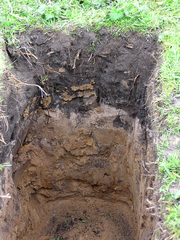
- Since the last Ice Age, mature soils have developed on thick layers of peat and river alluvium. The chalk bedrock supplied the soils with abundant lime-rich water through seepages and springs. In the valley's shallow basin this led to water-logged conditions in which decay of plant material was incomplete; these plant remains accumulated as fen peat.
- Peat wetlands formed on the sides of valleys and fed by chalky ground water which is poor in nutrients, are known as valley fens. The headwaters of the Little Ouse, and the Waveney immediately to the east, held the largest expanse of valley fen in lowland England.
- The very complex mixture of soils in the valley supported a great diversity of plant and animal communities, some of which were very rare.
- Human activity has increasingly shaped the environment of the Little Ouse valley, particularly over the last 200 years. Peat extraction, drainage, river engineering, water abstraction and pollution, and flood control have all had an impact.
We are grateful to Tim Holt-Wilson for providing this timeline.
The complex geological history of Little Ouse and neighbouring Waveney valley has resulted in many atypical and anomalous features that have puzzled geologists for hundreds of years. Between 2002 and 2007 Professor Richard West FRS undertook a detailed field study of the geomorphology of the area. This resulted in a theory that offers an elegant explaination of the origins of these features together with those of the valley fens and Breckland sands.
His work was published by the Suffolk Naturalists' Society with support from GeoSuffolk in January 2009. Entitled From Brandon to Bungay: An exploration of the landscape history and geology of the Little Ouse and Waveney Rivers, his book can be obtained from the Suffolk Naturalists' Society c/o Ipswich Museum, High Street, Ipswich, Suffolk IP1 3QH for £12 (incl. p&p or £10 if you collect it yourself). The soft back book contains 106 pages of text and diagrams plus 20 pages of colour plates (including eight excellent full page aerial photographs showing views of significant features of the valley).
For those wanting a shorter summary of Professor West's work, the attached pdf file contains the illustrated text of a lecture that he gave at the LOHP's annual meeting in 2006.
Click here  (NB. This is a large file: 8.14 MB).
Please note that the copyright for this article belongs to the LOHP and to Professor West. You are welcome to download it for individual use or for classroom handouts. Please contact the LOHP if you wish to make multiple copies for any other purpose.
A second short paper, The Little Ouse River, The Waveney River and the Breckland: a joint history, is published by the Suffolk Naturalists' Society in their transactions: 'Suffolk Natural History 2007, 43, 35-39.