Rural History
Social and Landscape History
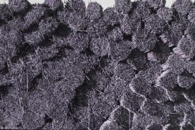
Reed harvest on the valley fens © David Orr
This page gives access to a wide variety of resources on the landscape, agricultural and social history of the Little Ouse headwaters. It includes research reports compiled on behalf of the LOHP by the Landscape Group, based at the University of East Anglia, as part of our Heritage Lottery Fund project in 2010-2013. Some of the information is of general applicability to the area (Table 1) and some is specific to the Waveney/Little Ouse valley Fens, to the Little Ouse headwaters, or to parishes or sites within the valley (Table 2).
We are still in the process of compiling this page - please visit again to find more information.
Table 1 General references to the management and history of the valley fens and associated habitats
| Author | Title | Reference | Content | Access it |
| S. Wade Martins | From Black-Face to White-Face- An Aspect of the Agricultural Revolution in Norfolk |
Agricultural History Review, 1993, 41, 20-30 | Examines the spread of new breeds of sheep across Norfolk in the early nineteenth century and the gradual eclipse of the Norfolk horn breed. Reference to Garboldisham. |
 |
| Raphael Holinshed & John Stow | Bottom Lands and Pasturage in late Sixteenth Century England |
Chronicles 1586 (Blackies English Texts ed.W.H.D. Rouse) |
On quality of grazing in flooded 'bottom' lands and higher 'meads' | |
|
Faden, W. |
Fayden's Map of Norfolk 1797 (1” to 1mile) |
The earliest inch-to-the-mile map of Norfolk in book form (map size A4) with an introduction by J.C. Barringer. Shows Norfolk largely before enclosure. |
purchase from Lark's Press | |
| Hodkinson, |
Hodkinson’s map of Suffolk in 1783 |
One mile to the inch, excellent reproduction of Hodkinson’s map in book form (A4 size). Introduction by David Dymond. |
|
|
| Bryant | Bryant's Map of Norfolk in 1826 |
A beautiful map of Norfolk which stands between Faden’s 1797 map and the first OS map, in book form. Scale 10 miles to 12 inches, shows parish boundaries. Introduction and analysis by J.C. Barringer |
||
|
|
Table 2 Site-related references to landscape and social history of the valley
| Sites covered | Title | Content | Source | Access it |
| All | Local History and the Little Ouse Headwaters Project: Heritage Audit |
Inventory and description of 'heritage assess' of the Little Ouse headwaters parishes with extensive bibliography of sources | UEA Landscape Group report to the LOHP | NB 8.5 Mb |
| Broomscot Common | Historical Notes | Notes on the common complied from Village of my Youth, by George Ling, and from the minute books of the Garboldisham Parish Charities | Mary Feakes | |
| Redgrave Fen |
Poor’s Fuel Allotment, Redgrave Fen |
A history of the management of the Fen from 1818 to 1960 | Article by Jean Sheehan on page 25 of Redgrave Parish Magazine, February 2013 | |
| The Little Ouse River | The Little Ouse: aspects of the history of a river | Examines both changes in the course of the river and its principal tributaries, and developments in the wider catchment which might have affected its character. | UEA Landscape group Report to the LOHP: Tom Williamson | |
| Rivers Waveney and Little Ouse | A Brief History of Land Use and Land Management in the Upper Valleys of the Waveney and Little Ouse | A Brief History of Land Use and Land Management in the Upper Valleys of the Waveney and Little Ouse | UEA Landscape group Report to the LOHP: Tom Williamson | Click here |